Glaciers of Wyoming
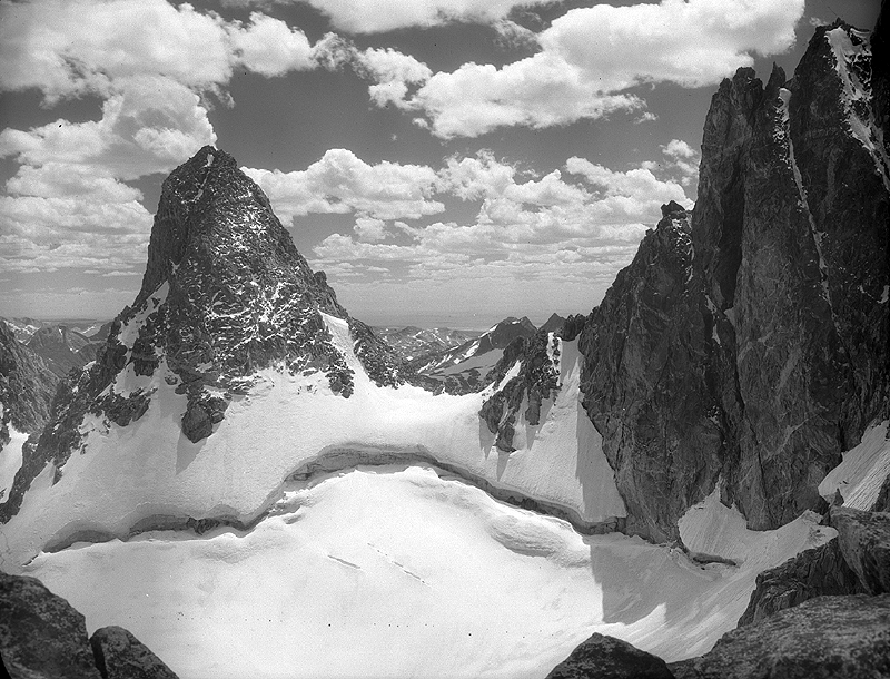
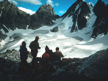
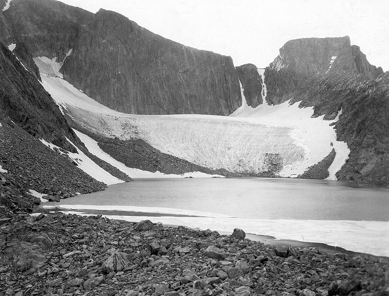
Sphinx Glacier (unofficial name) in 1950, Wind River Mountain Range (Mark F. Meier)
Welcome to the Glaciers of Wyoming web page. This web page describes the history and current extent of the various glaciated areas located in Wyoming. Currently Wyoming contains the largest glacier in the US Rocky Mountains and is home to 3 dozen other named glaciers of various sizes. Glaciers have played an important role in shaping the landscape of Wyoming by carving out valleys, eroding mountain peaks, creating lakes, and providing year round water to the many rivers in the area. Even today glaciers are playing an active role in shaping the Wyoming landscape. They are also recognized as indicators of climate change.
Contents
Glacier Extent
|
Blue Marble Imagery |
||
|
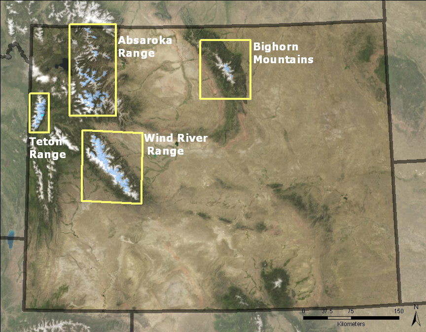
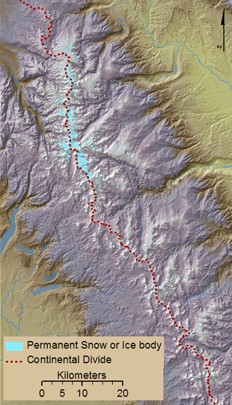
There are more than 1400 permanent snow or ice bodies in Wyoming, of which 110 are larger than 0.1 km2. There are 38 named glaciers: 1 located in the Bighorn Mountains, 2 in the Absaroka Mountains, 10 in the Teton Range, and 25 in the Wind River Range. The total area of Wyoming covered by permanent snow or ice bodies is roughly 73 km2, making it the second-most glaciated of the lower 48 states. The glaciated areas of Wyoming range from 42.6 to 45 degrees north and -107.1 to -110.9 degrees west. Note: all statistics here are based on USGS 1:24,000 scale topographic quadrangle maps which are based on mapping photography from dates between 1949 and 1994. |
||
History
Glacial History
|
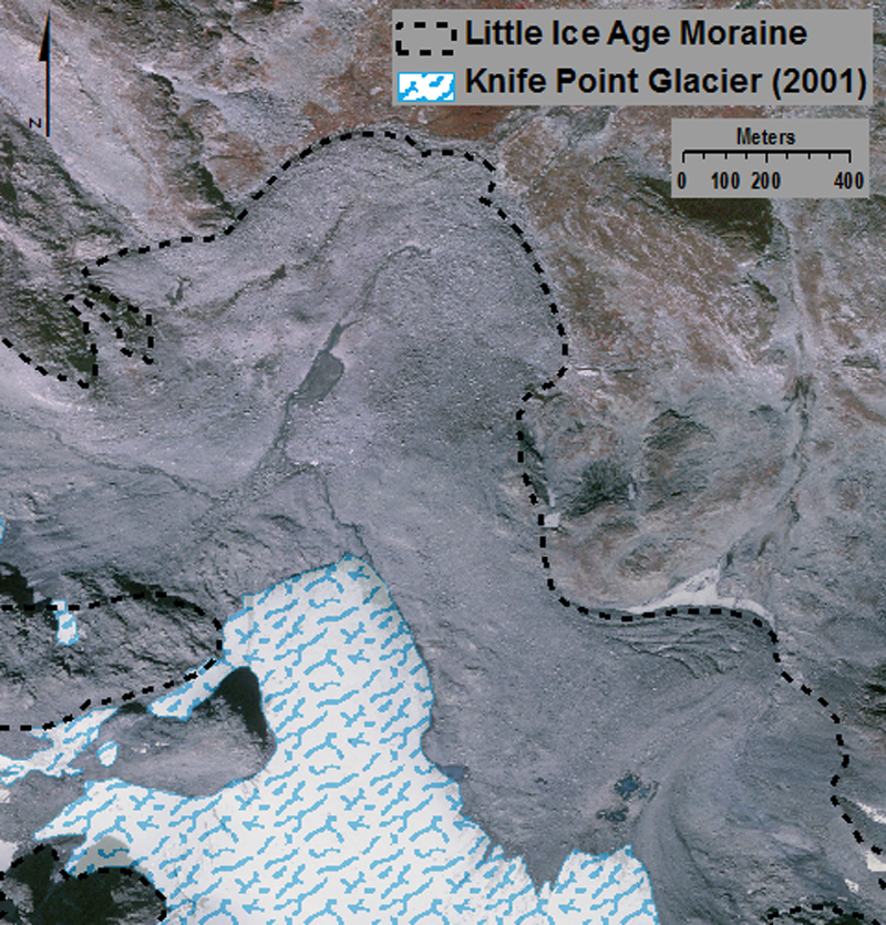
During the Pleistocene (~1.8 million years to 10,000 years ago), the Wyoming Rockies were covered by large ice caps (Breckenridge, 1973) that carved the valleys and created the topography we see today. Only the tallest peaks escaped being completely covered by ice. The best known Pleistocene Glaciations are the Bull Lake Glaciations (~140,000 years ago) and the Pinedale Glaciations (~30,000 years ago) (Pierce et al., 1976). These glaciations were named after the locations where the evidence first was discovered (Bull Lake, WY, and near Pinedale, WY). The most recent period of glacier advance occurred during the "Little Ice Age," which occurred from roughly 700 years ago to 150 years ago. Moraines formed during the "Little Ice Age" mark the maximum extent of the glaciers during that time period, and are still visible, even to an untrained observer, as shown by the images below. Since the end of the "Little Ice Age" and the early 20th century, the glaciers of the Wyoming Rocky Mountains have been generally retreating (Meier, 1951; Reed, 1964). |
|||
 |
 |
||
|
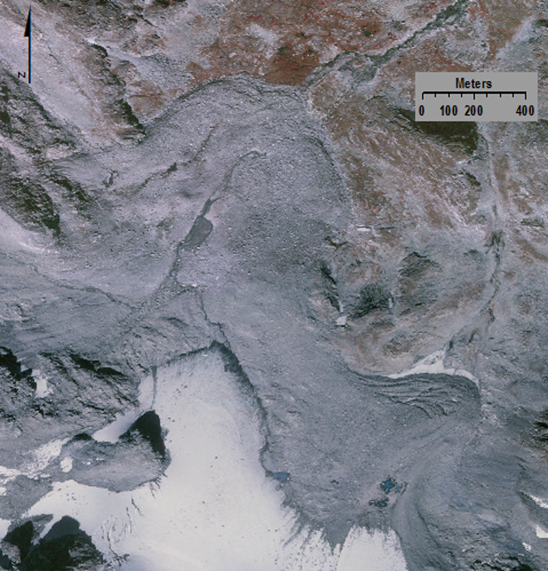
Visible "Little Ice Age" Moraines on Knife Point Glacier, Wind River Range. The moraines were delineated using Mark F. Meier's 1950 thesis maps as a guide (Meier, 1950). Aerial Photo: Sanborn Colorado, L.L.C) |
|||
Early Exploration
|
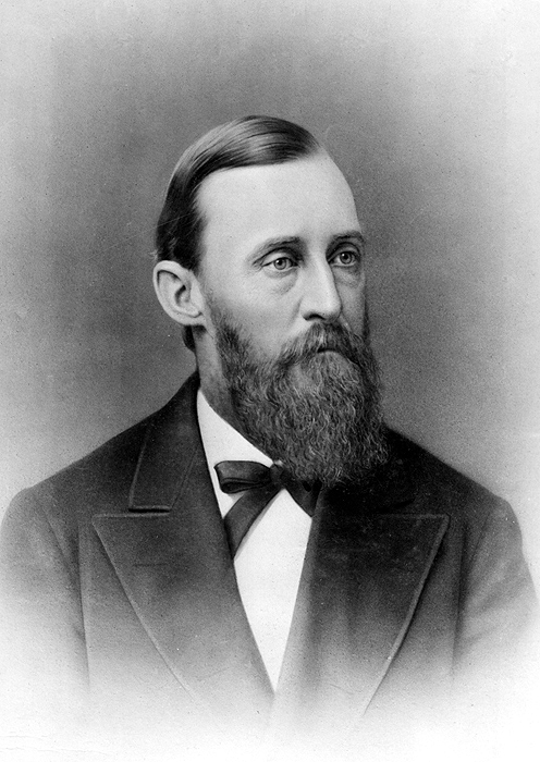
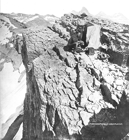
U.S. exploration of the Rocky Mountains began in the early 1800's from efforts to locate suitable passes over the continental divide. The earliest explorers had very little, if any, scientific training; some may have stood on active glaciers, but did not recognize them as such. John Fremont’s exploration of the Wind River Range in 1841 is just such an example. His exploration of Fremont's Peak was the first written account of the interior of this mountain range (Sprague, 1964), but it made no mention of glaciers despite the peak being nearly surrounded by glaciers. The glaciers remained unreported until the summer of 1877 when a party from the US Geological and Geographical Survey of the Territories arrived in the Wind River Range under the leadership of F.V. Hayden. This expedition, also known as the Hayden Survey, was the first to record and publish on the existence of glaciers located on the east side of Wind River Peak (Hayden, 1878). |
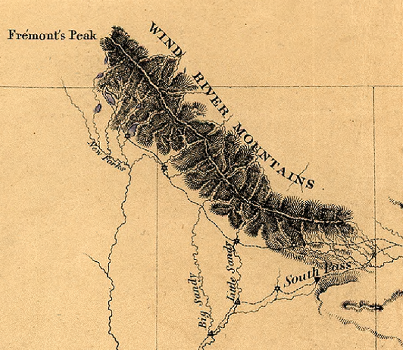 Map of an exploring expedition to the Rocky Mountains in the year 1842 by Brevet Capt. J.C. Fremont of the Corps of Topographical Engineers; lith by E Weber Co., Baltimore, Md. (Library of Congress) |
||||
|
|||||
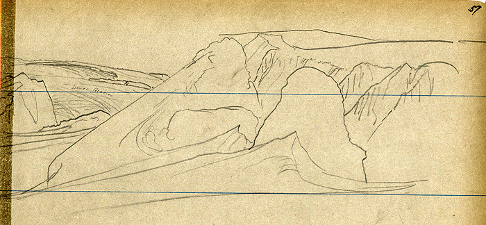
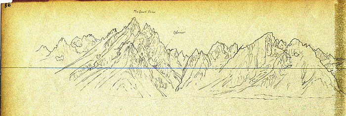 Geological and Geographical Survey of the Territories (Hayden Survey) sheet number 86. View of the Grand Tetons. The Grand Teton peak labeled and showing a glacier. Wyoming, August 18, 1878. (USGS Photo Archives Digital File: 830e0028) |
|||||
|
|||||
|
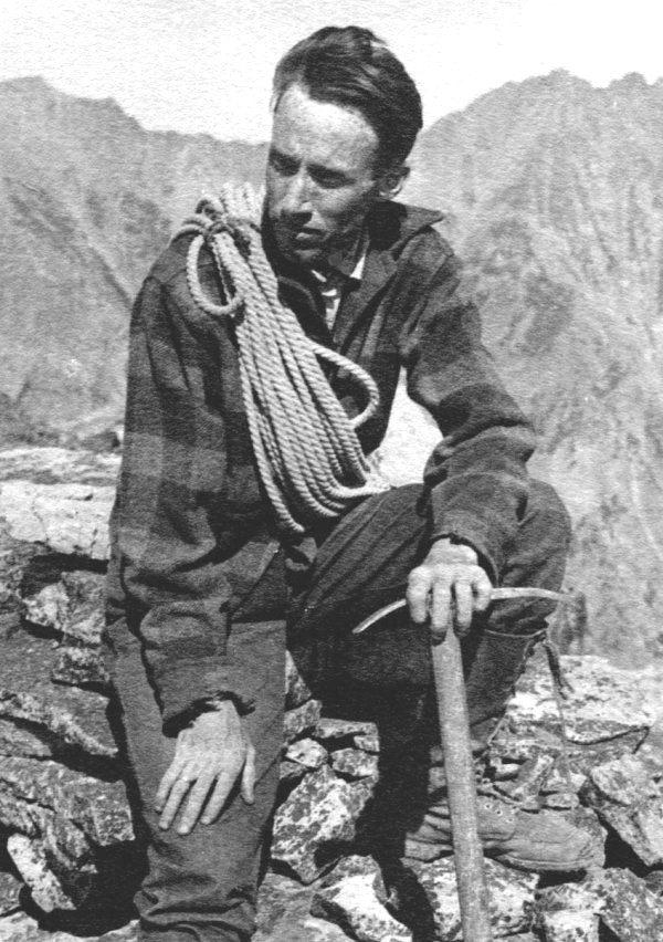
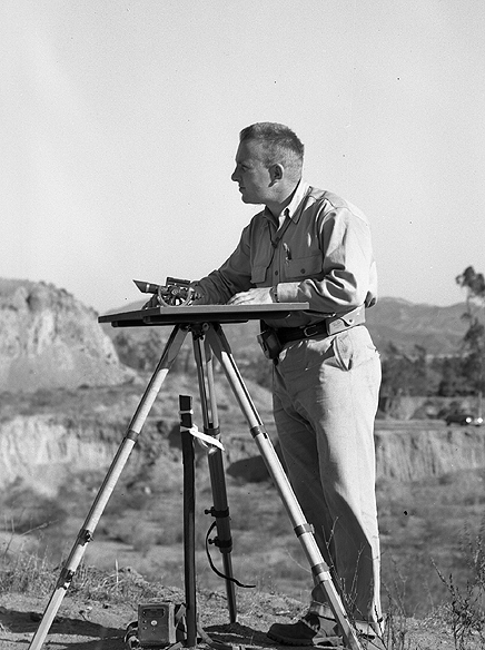
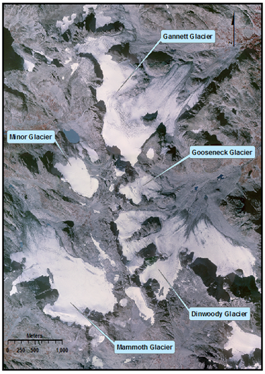
After the Hayden Expeditions, there were no scientific studies of the glaciers in Wyoming until 1926 when Dr. Fritiof Fryxell of Augustana College, Rock Island, Illinois explored the Tetons. Dr. Fryxell described in detail seven glaciers in the area surrounding Mount Moran and the Grand, Middle and South Teton peaks (Fryxell, 1935). The first scientific observation of the glaciers in the Wind River Range came in 1931 when C.K. Wentworth and D.M. Delo published their observations of Dinwoody, Gannett, and Gooseneck glaciers (Wentworth and Delo, 1931). Mark F. Meier in 1950 was the first to study the glaciers located around Gannett and Fremont peaks in detail. His Master’s Thesis (Iowa State University) mapped and recorded area measurements for 14 of the largest glaciers (Meier, 1951). |
|||||
|
|||||
Glaciated Regions
| Wind River Range | Teton Range | Absaroka | Big Horn |
Wind River Range
|
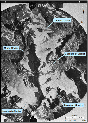
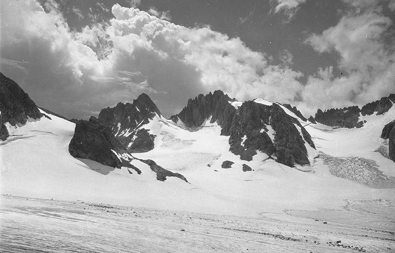
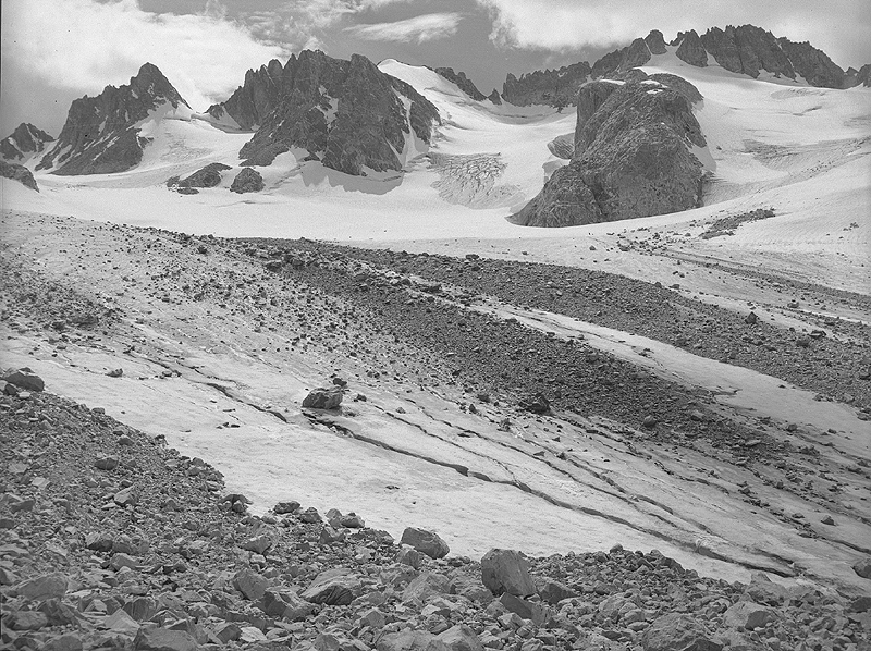
The Wind River Range spans 210 km along the continental divide in western Wyoming. Roughly 680 snow and ice bodies are located in the Winds, with a minimum elevation of 3113 m, maximum elevation of 4205 m, and mean elevation of 3536 m. The combined area is 55.8 km2. The range contains 25 of Wyoming's 38 named glaciers, including Gannett Glacier (3.3km2), the largest glacier in the continental U.S. outside of Washington State (Pochop, 1990). In fact, seven of the ten largest glaciers outside of the state of Washington are located within the Wind River Range. The Continental Divide runs the length of the Range and meltwater runoff flows to two different Oceans, Atlantic and Pacific. The western slopes contribute to the Colorado River Basin flowing into the Gulf of California, while the east slopes contribute to the Missouri River Basin flowing into the Gulf of Mexico (Pochop, 1990). The glaciers located in the Wind River Range are considered a vital water source to eastern Wyoming during the dry summer months and years of low precipitation (Pochop, 1989). |
 Permanent snow and ice bodies located within the Wind River Mountain Range.
|
|
 Eleven of the largest named glaciers located in the Wind River Mountain Range. |
Most of the glaciers located in the Wind River Range are north or east facing and found on the east slope of the continental divide (Meier, 1951). In the highest parts of the Winds, average annual snow fall is roughly 500cm (Pochop, 1989). In 1991 and 1998 the USGS drilled Upper Fremont Glacier to collect ice cores, which provided a record of the atmospheric conditions spanning 270 years (Krabbenhoft and Schuster, 2002). |
|
|
|
||
|
|
 View south southeast over Dinwoody Glacier. August 1984. (USGS Photo Archives Digital File: gdl00395) |
|
 Dinwoody Glacier 1950. (Mark F. Meier) |
 View southeast over Dinwoody Glacier August 1984. (USGS Photo Archives Digital File: Digital File:gdl00388) |
|
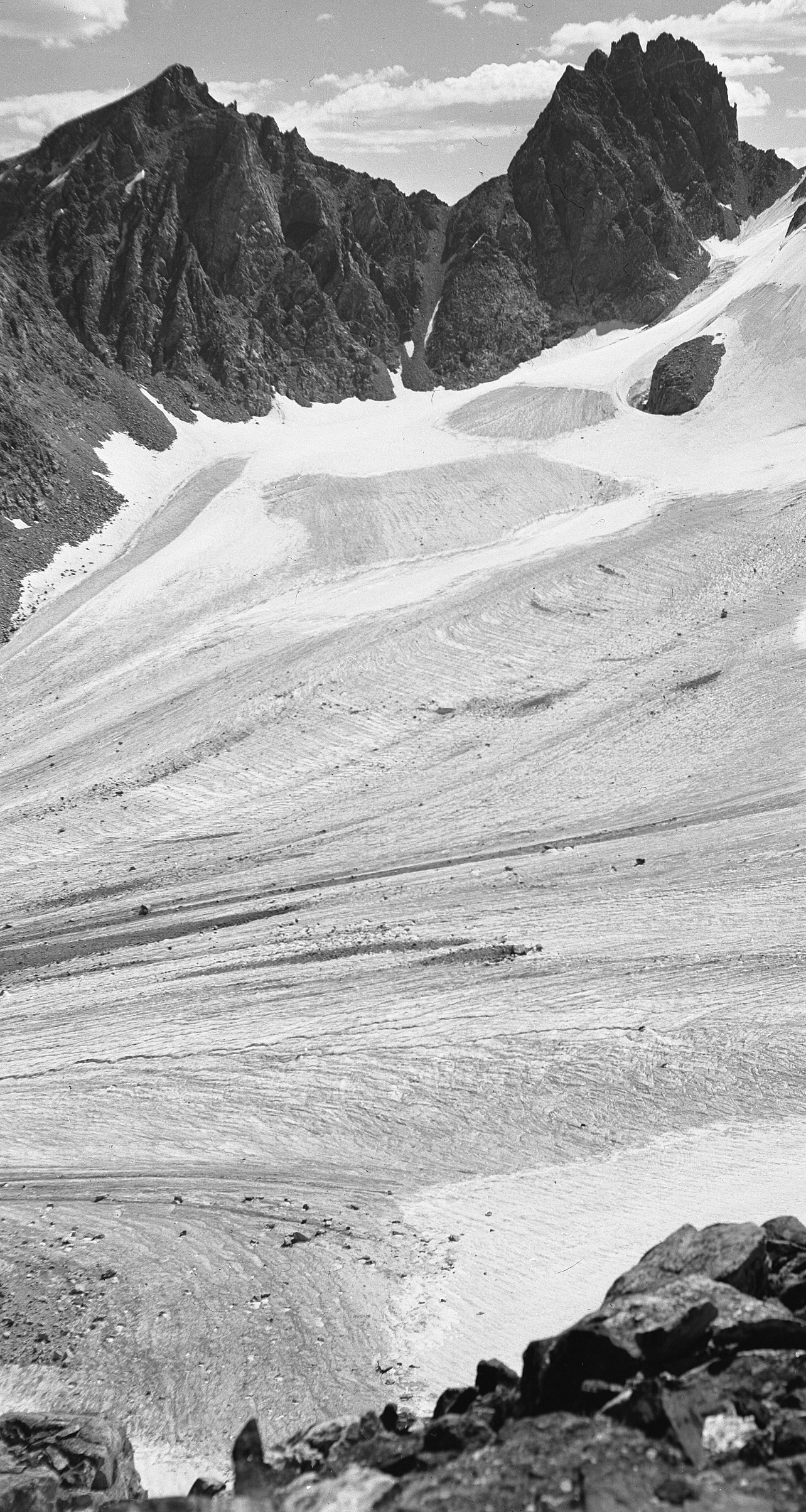
 Orthorectified areial photos of the glaciers around Gannett peak taken in 1950. (1950 Aerial Photo: Mark F. Meier) |
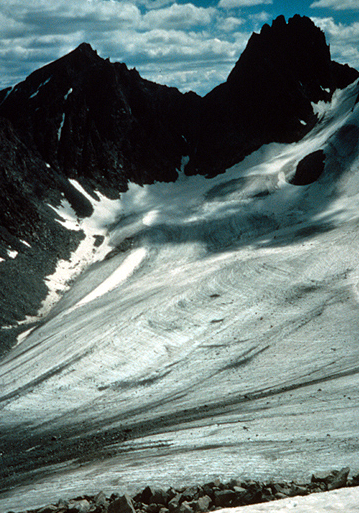
 Orthorectified areial photo of the glaciers around Gannett peak taken in 2001. (2001 Aerial Photo: Sanborn Colorado, L.L.C) |
|
Back to Glaciers in Wyoming
Back to Contents
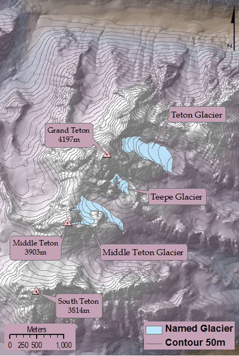
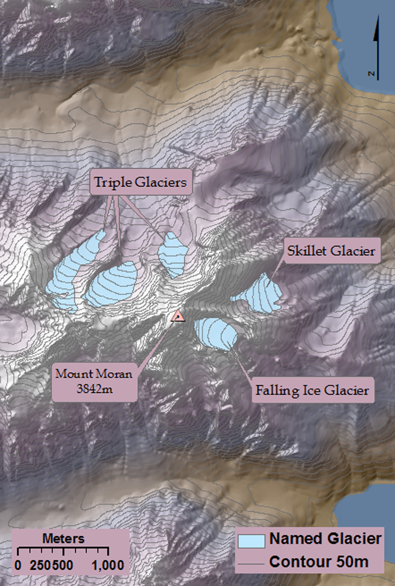
Teton Range
|
The Teton Range spans 65 km in western Wyoming along the Wyoming - Idaho border. There are roughly 276 permanent snow and ice bodies with a minimum elevation of 2694m, maximum elevation of 4096m, mean elevation of 3127m, and a combined area of 6.9 km2. The Tetons contains 10 of Wyoming's 38 named glaciers, the largest of which is Teton Glacier (0.30 km2). The majority of the glaciers in the Tetons have north or east aspect, with the exception of Falling Ice Glacier on Mount Moran, which faces southeast. All the glaciers are located on the east slope of the mountain range, and like the glaciers of the Wind River Range, this is most likely due to the decreased solar radiation and predominantly westerly winds (Fryxell, 1935).
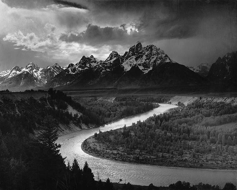
Teton Range and Snake River, 1942. (Ansel Adams, National Archives File: 79-AAG-1)
|
 Permanent snow and ice bodies located within the Teton Mountain Range. |
||||
|
|||||
|
The glaciers in the Tetons have a history of being overlooked by scientists. They were not scientifically studied until 1926 when Fritiof Fryxell surveyed the range. Even the members of the Hayden survey that had come to the Tetons on two previous trips had missed the glaciers; they remarked on the extensive evidence of past glaciers, but found no "living" glaciers in the mountain range (Fryxell, 1935). In fact, F.H. Bradley of the first survey that visited the mountain range in 1872 wrote "the water of these mountains [the Tetons] is so pure as to make certain that not the least glacial erosion is now going on at any point on the range." (Bradley, 1873). Even after the Hayden Survey confirmed the existence of glaciers in 1878, they did not include the glaciers on the topographic map of the area published in 1914 (surveyed in 1898 - 1899) and even included the statement in its descriptive: “owing to small snowfall it (the Teton Range) carries no glaciers.” (Fryxell, 1935) |
 Rock outcrop near Teton Glacier August 19, 1963. (A.S. Post, University of Washington) |
||||
|
After Fryxell published his observations on the glaciers, it wasn't until 14 years later that an actual survey of one of the glaciers was performed. Carl E. Jepson surveyed Teton Glacier in 1949 and 1950, followed by another survey of the glacier by M.T. Millett in 1960; unfortunately the results of neither survey were published (Reed 1964). In 1963 John C. Reed Jr. completed an extensive survey of Teton Glacier, including area measurements and depth estimates. He also compiled all previous known data on the glacier in an attempt to reconstruct past behavior and future changes. Reed continued to monitor Teton Glacier until 1967 (Reed, 1967). |
|||||
Back to Glaciers in Wyoming
Back to Contents
Absaroka Mountains
|
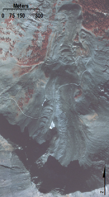
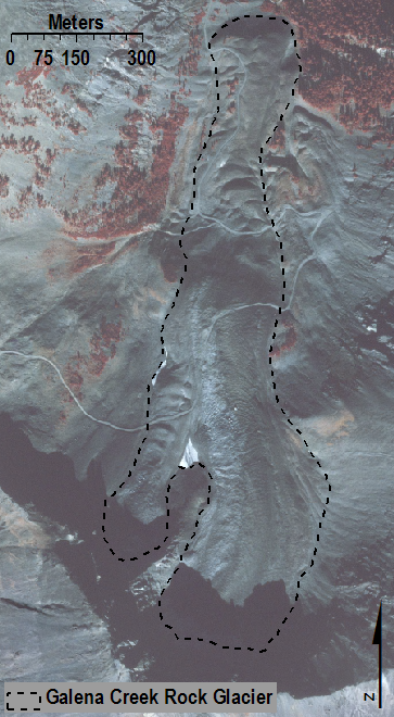
The Absaroka Mountains span 240 km along the eastern border of Yellowstone National Park in northwestern Wyoming and southern Montana. There are roughly 506 snow and ice bodies with a total area of 9.6 km2. Minimum elevation is 2803m, maximum elevation is 3664m, and mean elevation is 3273m. The Absaroka Mountains contain 2 of Wyoming's 38 named glaciers, the larger of which is Fishhawk Glacier (0.25km2). The Absaroka Mountains also contain the well studied Galena Creek Rock Glacier (Ackert, 1998; Potter et al., 1998). |
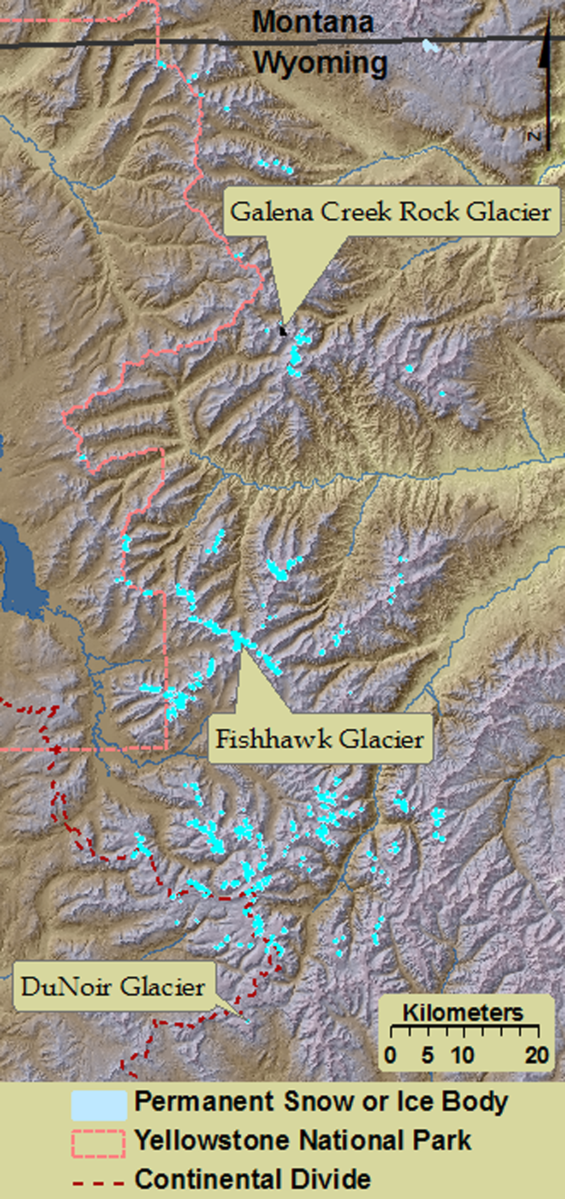 Permanent snow and ice bodies located within the Absaroka Mountain Range. |
||||||||
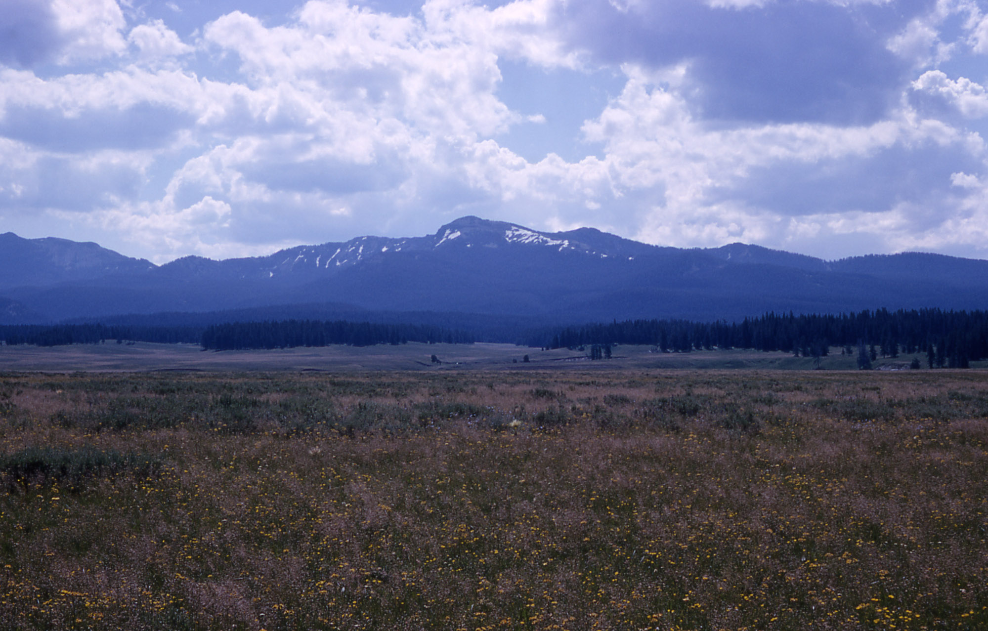 Absaroka Range as seen from Pelican Valley. 1965. NPS Photo by RG Johnson |
|||||||||
|
|||||||||
Back to Glaciers in Wyoming
Back to Contents
Big Horn Mountains
|
The Big Horn Mountains span 320 km in central northern Wyoming and southern Montana. The Big Horns contain roughly 16 snow and ice bodies with a total area of 0.97 km2. They have a minimum elevation of 3197m, maximum elevation of 3730m, and mean elevation of 3415m. The Big Horn Mountains contain only 1 of Wyoming's 38 named glaciers, Cloud Peak Glacier (0.23km2). Rahn et al. (2006) estimated that if the melting continues at the rate that was calculated in 2005, Cloud Peak Glacier will disappear completely sometime between the years 2020 and 2034. |
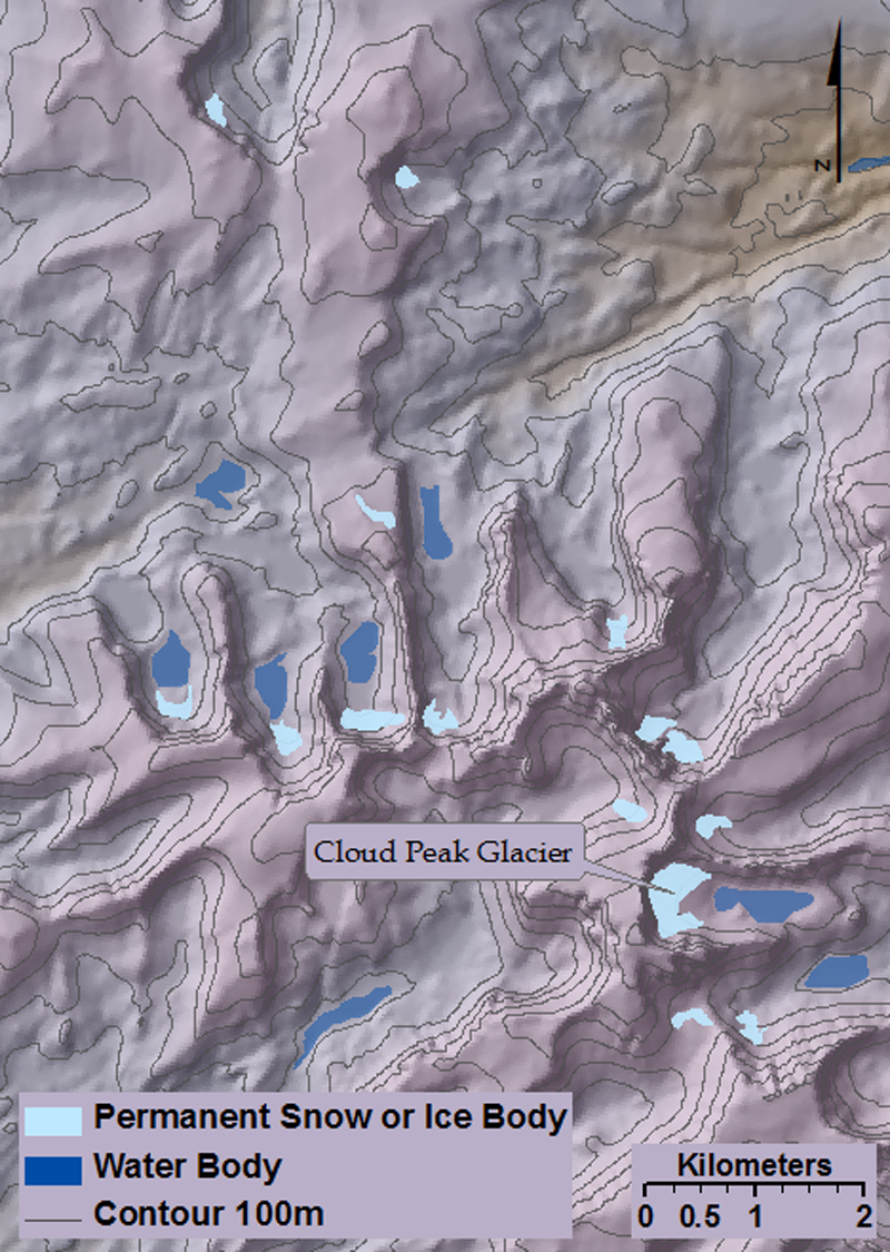 Permanent snow and ice bodies located within the Big Horn Mountain Range. |
 Cloud Peak Glacier 1903. (USGS Photo Archives Digital File: dnh00929 |
Back to Glaciers in Wyoming
Back to Contents
Glacier Change
|
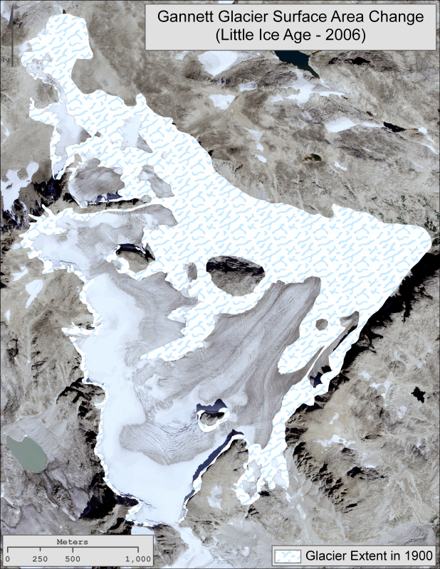
The area of Gannett Glacier has been reduced by roughly 44.8% between the end of the "Little Ice Age" and 2001. |
 |
Comparison Photos
|
Dinwoody Glacier in 1964 (left, from USGS) and in 2009 (right, photo by John Scurlock)
|
|
Sacagawea Glacier in 1961 (left, from University of Washington) and in 2009 (right, photo by John Scurlock) |


Fun Facts
|
A rare photo of a wild Jackalope.
|
Links
| Glaciers of the American West States with Glaciers Portland State University Glacier Research |
Bibliography
|
Ackert, R. P., 1998, A rock glacier/debris-covered glacier system at Galena Creek, Absaroka mountains, Wyoming: Geografiska Annaler Series a-Physical Geography, v. 80A, no. 3-4, p. 267-276. Bradley, F. H., 1873, Explorations of 1872: U.S. Geological Survey of the Territories, under Dr. F.V. Hyden; Snake River Division: The American Journal of Science and the Arts, v. 6, p. 194-207. Breckenridge, R. M., 1973, Glaciation of Northwestern Wyoming Interpreted From ERTS-1: Symposium on Significant Results Obtained from the Earth Resources Technology Satellite, NASA Goddard Space Flight Center. v. 1 p. 363-369. Fryxell, F., 1935, Glaciers of the Grand Teton National Park of Wyoming: The Journal of Geology, v. 43, no. 4, p. 381-397. Hayden, F. V., 1878, Discovery of recent glaciers in Wyoming: The American Naturalist, v. 12, no. 11, p. 830-831. -, 1880, The Annual Report of the Hayden Survey for 1877: The American Naturalist, v. 14, no. 5, p. 360. Krabbenhoft, D. P., and Schuster, P. F., 2002, Glacial ice cores reveal a record of natural and anthropogenic atmospheric mercury deposition for the last 270 years: USGS Fact Sheet 051-02. Meier, M. F., 1951, Glaciers of the Gannett Peak-Fremont Peak area, Wyoming: M.S. Geoscience, University of Iowa. Pierce, K. L., Obradovich, J. D., and Friedman, I., 1976, Obsidian hydration dating and correlation of Bull Lake and Pinedale glaciations near West Yellowstone, Montana: Geological Society of America Bulletin, v. 87, no. 5, p. 703-710. Pochop, L. O., 1989, Long-term trends in glacier and snowmelt runoff, Wind River Range, Wyoming: Project Report Prepared for Wyoming Water Research Center, University of Wyoming. 50 p. -, 1990, Glacial icemelt in the Wind River Range, Wyoming: Project Report Prepared for Wyoming Water Research Center, University of Wyoming. 6 p. Potter, N. J., Steig, E. J., Clark, D. H., Speece, M. A., Clark, G. M., and Updike, A. B., 1998, Galena Creek Rock Glacier Revisited: New Observations on an Old Controversy: Geografiska Annaler. Series A: Physical Geography, v. 80, no. 4, p. 251-265. Rahn, P., Ray, C., and Rahn, M., 2006, The Last Glacier in the Big Horn: The Professional Geologist, v. 43, no. 2, p. 43-46. Reed, J. C., 1964, Recent retreat of the Teton Glacier, Grand Teton National Park, Wyoming: U.S. Geological Survey Professional Papers, v. 501C, p. C147-C151. -, 1967, Observations on the Teton Glacier, Grand Teton National Park, Wyoming, 1965 and 1966: U.S. Geological Survey Professional Papers, v. 575C, p. C154-C159. Sprague, M., 1964, The Great Gates: The Story of the Rocky Mountain Passes. Little, Brown Press, Boston. 468 p. Wentworth, C. K., and Delo, D. M., 1931, Dinwoody Glaciers, Wind River Mountains, Wyoming; With a Brief Survey of Existing Glaciers in the United States, v. 42, p. 605-620. |
Created by Mark Devisser: 10.09.06
Last modified: 31 Aug 2011