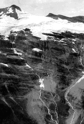
Glaciers of Montana
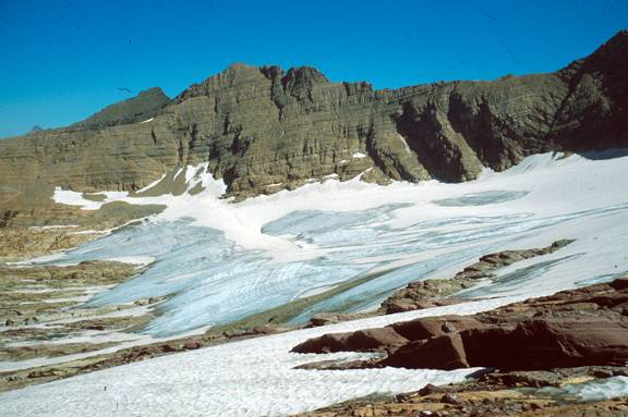 Sperry Glacier, Lewis Range, 1981. Paul Cararra, US Geological Survey |
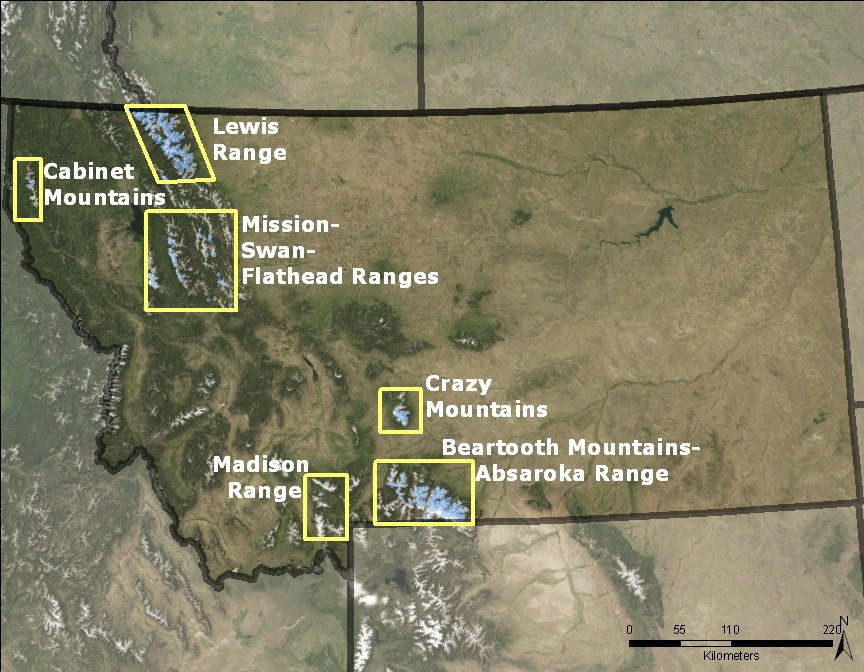
Welcome to the Glaciers of Montana website. The glaciers in this state are found in the western mountain ranges, the eastern most of which are the Crazy Mountains. While the glaciers of Glacier National Park draw most of the attention, other mountain ranges of the state contain glaciers. Some of Montana’s glaciers are known for their frozen contents, grasshoppers.
Glacier Extent
 |
| Blue Marble Imagery |
|
There are more than 1100 perennial snow or ice features mapped in Montana, but only 153 are larger than 0.1 km2, and 62 are officially named. The total area of all the mapped snow and ice in Montana is about 68.6 km2. Glaciers are found in the Lewis and Livingston ranges of Glacier National Park; the Flathead, Madison, Mission, and Swan ranges; and the Cabinet, Crazy, and Beartooth-Absaroka mountains. Each is examined further below. Note: all statistics here are based on USGS 1:24,000 scale topographic quadrangle maps which are based on mapping photography ranging from 1958 to 1982. Most glaciers and snowfields in Montana occur in east- to north-facing cirques at high elevations near the ridge crests. These locations are shaded from the sun and favor snow accumulation from avalanches and windblown snow in the winter. None of these glaciers could exist today without these topographic benefits. |
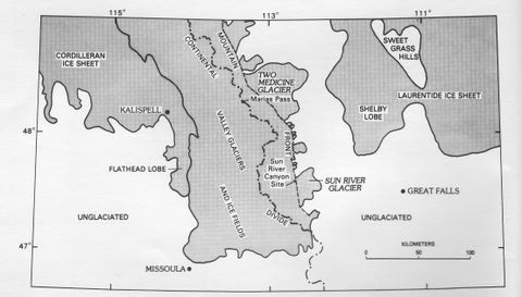
Glacial History
|
||||
|
||||
Early Exploration
|
The first recorded observation of a glacier in Montana was probably by lieutenants John Van Orsdale and Charles Woodruff. In the summer of 1873 they lead a contingent of the 7th Infantry from Fort Colville to Fort Shaw in an attempt to find a route through the dense forests in the Lewis Range. Today this region is known as Glacier National Park. Ten years later, in August 1883, the glacier was 'rediscovered' by geologist Raphael Pumpelly, while leading the Northern Transcontinental Survey through the Lewis Range to map the railroad land grants (Ober, 2004). This second ‘discovery’ was soon telegraphed to the papers and today the glacier bears his name, although at the time there was some grumbling about the original discovery by Van Orsdale. Interestingly, it was Van Orsdale, who joined the Pumpelly group as a volunteer, who telegraphed the discovery and promoted Pumpelly's name. |
||||
 From My Reminiscences, R. Pumpelly, 1918 |
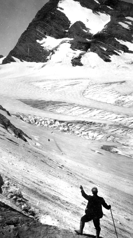
 Pumpelly Glacier July 1914 |
|||
|
The editor of a popular outdoor magazine, George B. Grinnell, visited the region in 1885. His visit was apparently inspired by articles about the region that appeared in his magazine. On his second trip in 1887, he spent time in the Swiftcurrent valley, eventually 'discovering' the glacier that bears his name. He became enchanted with the region, and returned annually to advocate for its preservation as national park. |
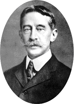 George B. Grinnell |
|||
 Grinnell Glacier 1920
|
||||
|
The first scientific report of glaciers in Montana came out in 1895 by Professor L.W. Chaney Jr. of Carleton College, Northfield, MN. He was a member of a small expedition led by his former Carleton professor, L.B. Sperry. Although the Pumpelly and Grinnell glaciers had been identified by this time, the purpose of the expedition was to find a glacier more easily accessible to the 'ordinary tourist'. They found a feature, that, despite the extensive seasonal snow cover, was identified as a glacier because of four characteristics: crevasses (indicative of movement); milky stream water (indicating subglacial erosion, also a result of movement); a moraine at the foot of the glacier (indicating rock transport); and ice (indicating the perennial nature of the feature) (Chaney, 1895). Sperry named the glacier 'Chaney Glacier.' Sperry returned the next summer 1896 and investigated Avalanche Basin, from which a milky stream was observed flowing. He found another glacier, later to be named the Sperry Glacier. Sperry’s investigations of the region are covered in an interesting book by his nephew, A.P. Sperry, entitled Avalanche. |
||||
|
Lyman B. Sperry, Undated
|
L.W. Chaney, c. 1895
|
|||
|
Sperry Glacier, 1911
|
Chaney Glacier, 1936
|
|||
|
In the southern portion of the Montana, near the Wyoming border, a USGS geologist named James R. Kimball was mapping the Granite Range, now known as the Beartooth Range, in the summer of 1898 (Kimball, 1899). He was the first to report glaciers in the Beartooth, correcting the reported absence of glaciers by the Hayden Survey of 1878 (Powell, 1885). His expedition, which included photographer Anders Beers Wilse, was the first to report and photograph the Grasshopper Glacier. This glacier, flowing on the slopes of Mt. Wilse, was already informally named by local prospectors and miners who worked the area. The name derives from the presence of an extensive layer of grasshoppers presumably entombed during the grasshopper plagues of the west (Lockwood et al., 1990). Grasshoppers are not unique to this glacier; three other glaciers are named Grasshopper, another one in the Beartooth, one in the Crazy Mountains, MT, and one in the Wind River Range of Wyoming. Several differently named glaciers also contain grasshoppers (Lockwood et al., 1991). However, this Grasshopper Glacier in the Beartooth is the most studied (e.g. (Kimball, 1899; Alford, 1970; Ferrigno, 1985)). In the following century, most of the scientific efforts focused on the glaciers of Glacier National Park, most notably the work by Dyson (1948), Johnson (1980), and Carrara (1987). Since that time much of the glacier work has been lead by D. Fagre, e.g. (Hall and Fagre, 2003). |
||||


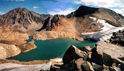
Glaciated Regions
| Lewis - Livingston Ranges Glacier National Park | Cabinet Mountains, Mission, Swan, and Flathead Ranges | Madison Range | Crazy Mountains | Beartooth-Absorka Mountains |
Lewis-Livingston Ranges, Glacier National Park
|
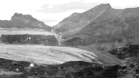
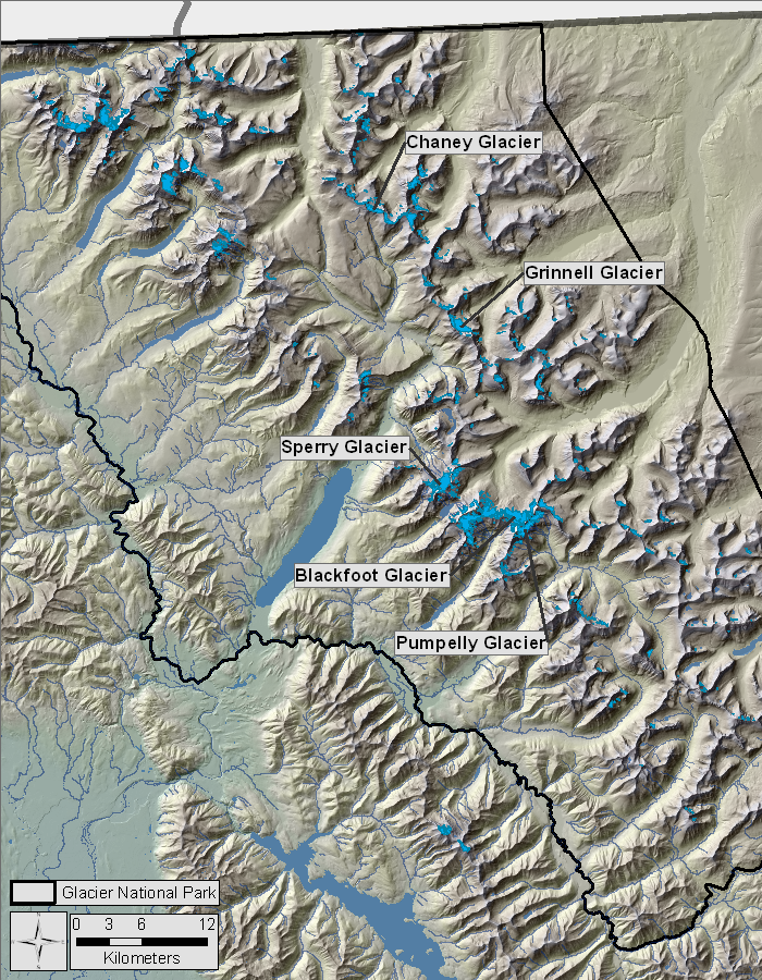
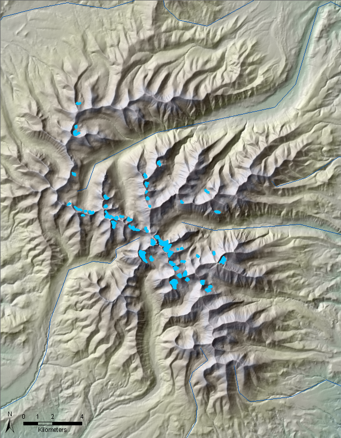
The total ice-covered area in the Lewis and Livingston ranges of Glacier National Park is about 40.5 km2, representing 59% of the total ice-covered area in the state. There are 604 individual glaciers and perennial snowfields, 52% of the total number in the state. The largest glacier, and the largest glacier in the state, is Blackfoot Glacier, 1.75km2 (1966). Of the ten largest glaciers in the state, nine are found here. Only 39 glaciers are named, about two-thirds of the named glaciers in the state. The mean elevation of glaciers and perennial snowfields range from 1651 m to 3110m, with an average elevation of 2260m. As outlined in the section on Early Explorations, glaciers in Montana were first ‘discovered’ in this region and most intensively studied. |
Shaded relief map of the Lewis-Livingston Ranges.
|
|
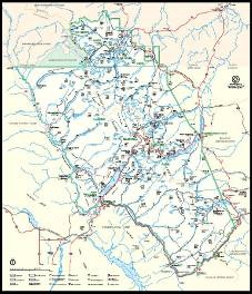
Map of Glacier National Park |
|
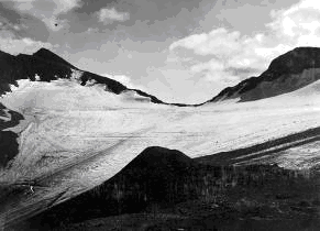
 Blackfoot Glacier visited in 1913 |
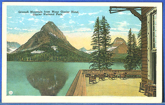 Postcard of Glacier National Park, circa 1920 by E.C. Kropp. |
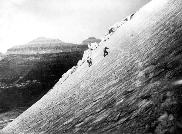 Climbing Blackfoot Glacier, 1914. |
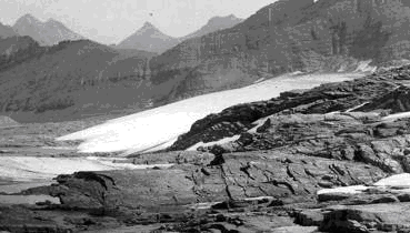
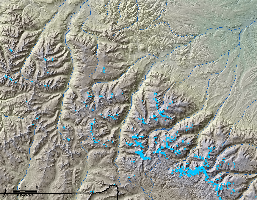
Cabinet Mountains and Mission, Swan and Flathead Ranges
|
These ranges contain small glaciers and perennial snowfields, only nine of which are named. Together they contain 89 features, totaling 4.3 km2, representing 8% of the glacier population and 6% of the ice-covered area in Montana. They range in size from 0.001 to 0.46 km2, the largest of which is the McDonald Glacier. The elevation range of the glaciers and perennial snowfields is 1938 m to 2675 m, with an average elevation of 2426 m. |
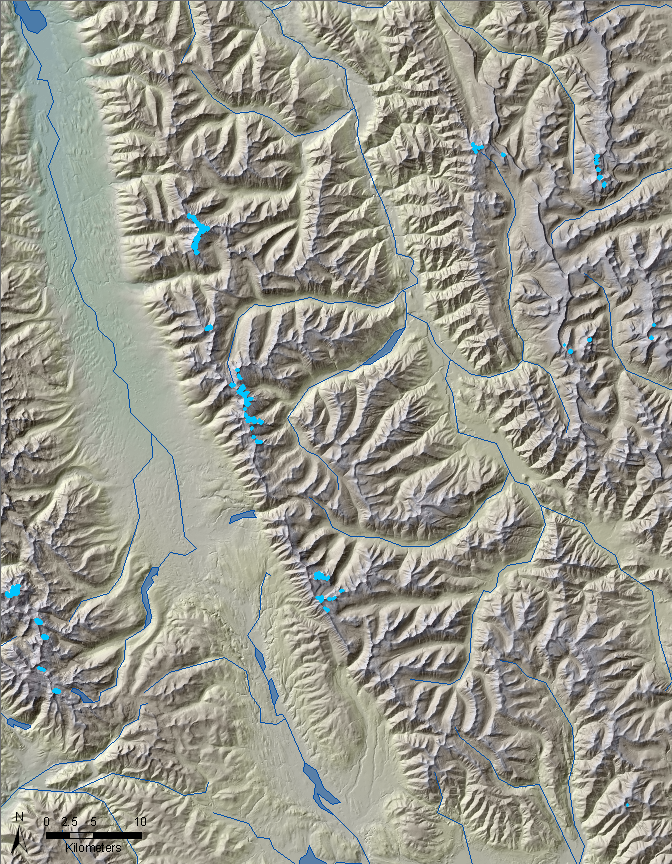 Shaded relief map of the Cabinet Mountains, Mission, Swan and Flathead Ranges. |
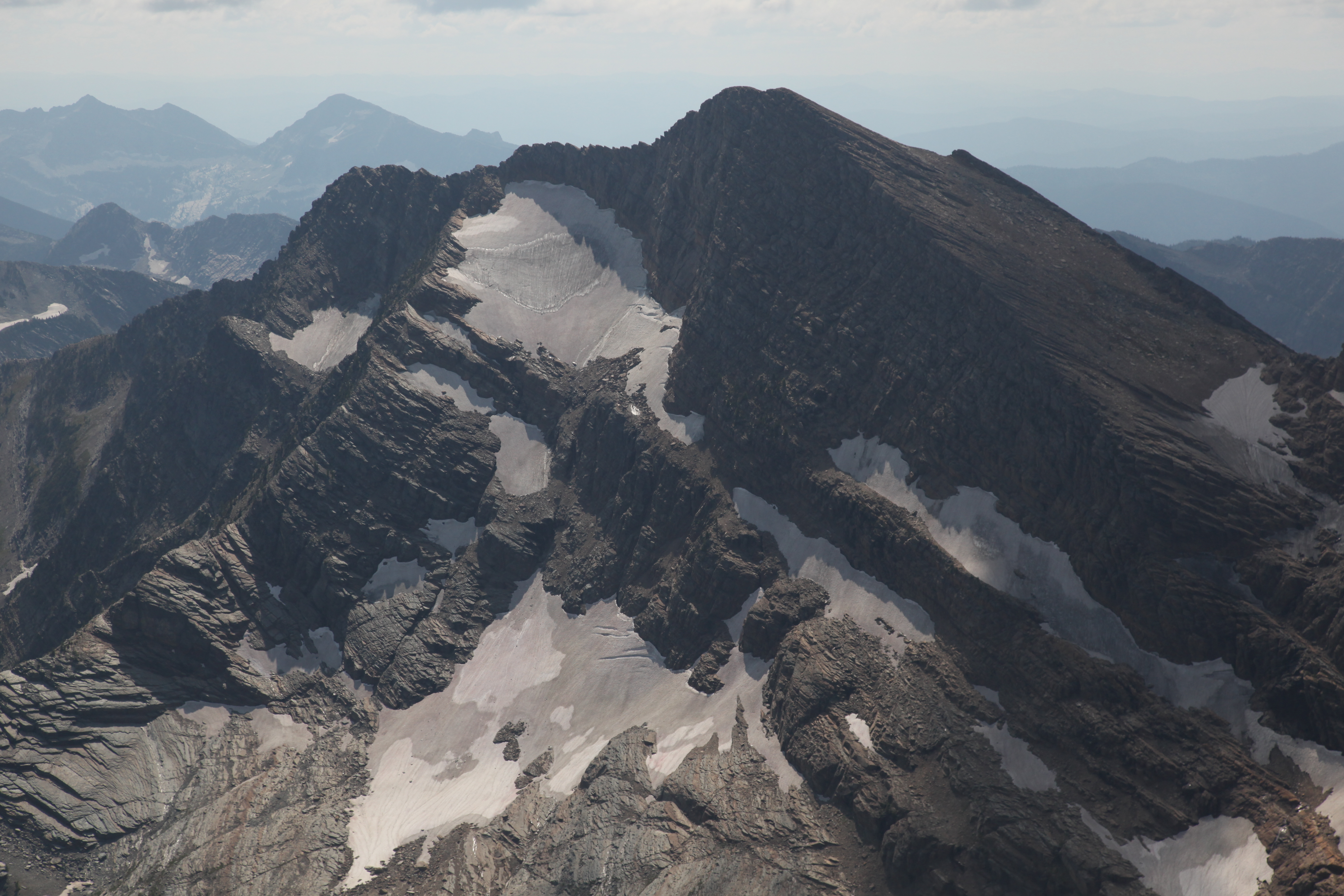 Blackwell Glacer, Cabinet Mountains. August 31, 2009. John Scurlock.
|
Madison Range
|
Only nine perennial ice features are present in the Madison Range, and they are all snowfields according to the US Geological Survey maps. None of them are named. The total snow-covered area is 0.057 km2 and the largest single feature is 0.025 km2. The mean elevation of these features is 2947 m with a range of 2838 m to 3243 m. Most of the snowfields are located on Lone Mountain, which is also occupied by Big Sky Ski Resort. The largest snowfield apparently feeds a rock glacier on the northeast slope of Lone Mountain. Other rock glaciers are noted on some of the peaks in the Madison Range. |
Shaded relief map of the Madison Range.
|
|
|

Crazy Mountains
|
The Crazy Mountains contain 57 glaciers and perennial snowfields, representing 5% of the population in Montana, and totaling 1.9 km2. The smallest feature is 0.003 km2 and the largest is only 0.16 km2. The only named glacier in the range is Grasshopper Glacier, (the second ‘other’ such named glacier) with an area of about 0.68 km2. The elevation of the features ranges from 2677 m to 3160 m, with an overall average of 2860 m. |
Shaded relief map of the Crazy Mountains.
|
 Crazy Mountains. |
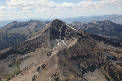
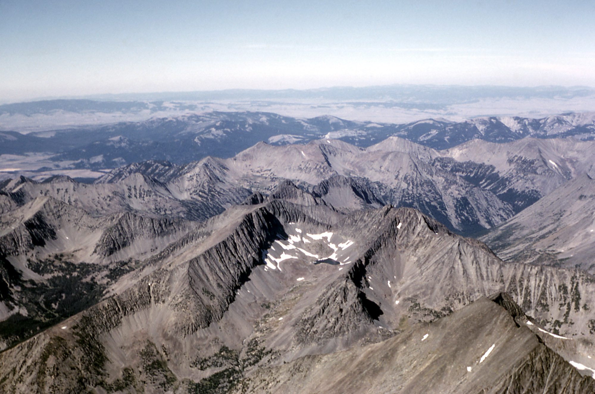
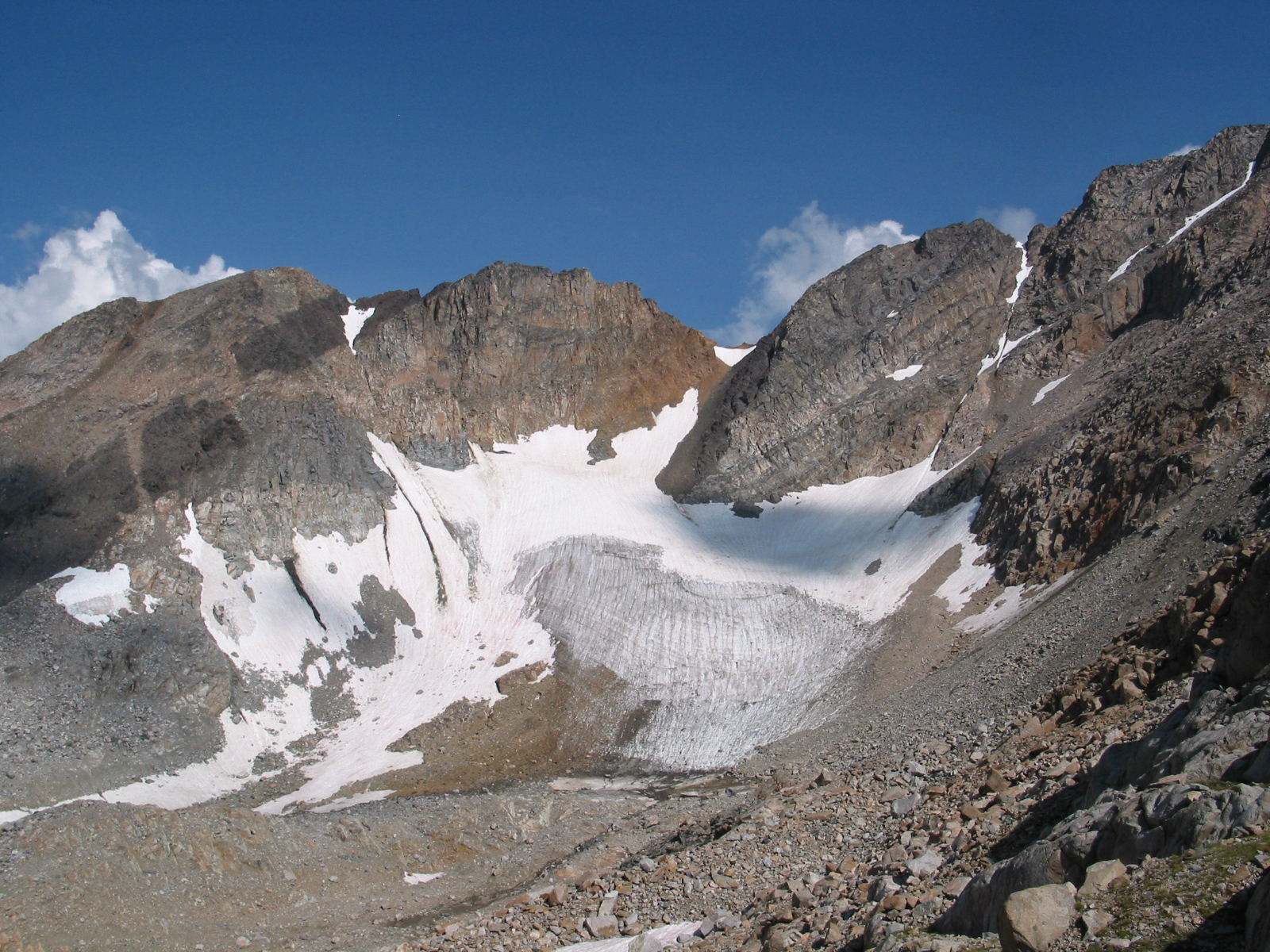
Beartooth and Absorka Ranges
|
||
|
Comparison Photos
|
Grinnell Glacier, Lewis Range, in 1910 (left, from GNP Archives) and 1998 (right, photo by Karen Holzer, USGS) |
|
Shepard Glacier, Lewis Range, in 1913 (left, from USGS) and 2005 (right, from USGS) |


Fun Facts
|
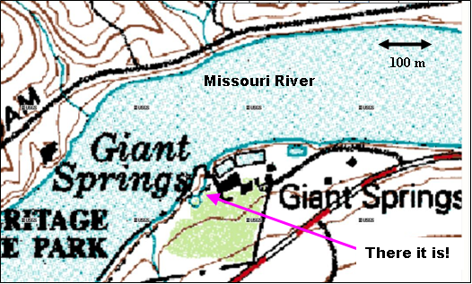 Location of the Roe River, just upstream from Great Falls, Montana. |
|
 Photo of a Montanan |
|
|
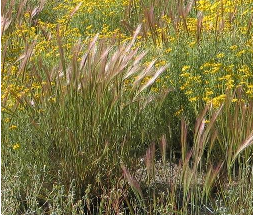 Bluebunch Wheatgrass Agropyron spicatum (Pseudoroegneria spicatum) Source: US Forest Service |
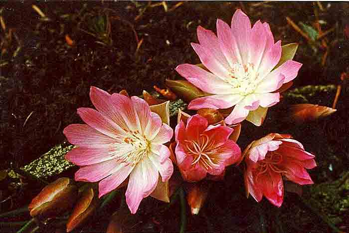 Bitterroot (Lewisia rediviva) Source: US Forest Service |
|
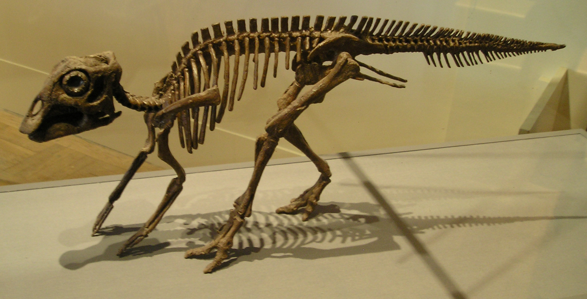 Baby Maiasaur skeleton, Maiasaur from the Royal Ontario Museum, Toronto. |
Links
| Glaciers of Glacier National Park, USGS Grasshopper Glacier, USFS |
References
|
Alford, D., 1970, Mass-balance studies: Grasshopper Glacier, Montana: Arctic and Alpine Research, v. 2, p. 72-79. Carrara, P. E., 1987, Holocene and latest Pleistocene glacial chronology, Glacier National Park, Montana: Canadian Journal of Earth Sciences, v. 24, p. 387-395. Carrara, P. E., Short, S. K., and Wilcox, R. E., 1986, Deglaciation of the Mountainous region of Northwestern Montana, USA, as indicated by Late Pleistocene ashes: Arctic and Alpine Research, v. 18, no. 3, p. 317-325. Chaney, L. W. J., 1895, A glacier in the Montana Rockies: Science, v. 2, no. 50, p. 792-796. Dyson, J. L., 1948, Shrinkage of Sperry and Grinnell Glaciers, Glacier National Park, Montana: Geographical Review, v. 38, no. 1, p. 95-103. Ferrigno, J. G., 1986, Recession of Grasshopper Glacier, Montana, since 1998: Annals of Glaciology, v. 8, p. 65-68. Hall, M. H. P., and Fagre, D. B., 2003, Modeled Climate-Induced Glacier Change in Glacier National Park, 1850-2100: Bioscience, v. 53, no. 2, p. 131-140. Johnson, A., 1980, Grinnell and Sperry Glaciers, Glacier National Park, Montana: A Record of Vanishing Ice: USGS Professional Paper, v. 1180, p. 29. Kimball, J. P., 1899, The Granites of Carbon County, Montana: A Division and Glacier Field of the Snowy Range: Journal of the American Geographical Society of New York, v. 31, no. 3, p. 199-216. Lockwood, J. A., Nunamaker, R. A., Pfadt, R. E., and Debrey, L. D., 1990, Grasshopper Glacier: Characterization of a vanishing biological resource: American Entomologist, v. 36, no. 1, p. 18-27. Lockwood, J. A., Nunamaker, R. A., Pfadt, R. E., Love, C. M., Thompson, C. D., and Debrey, L. D., 1991, Preserved grasshopper fauna of Knife Point Glacier, Fremont County, Wyoming, USA: Journal of Arctic and Alpine Research, v. 23, no. 1, p. 108-114. Ober, M. J., 2004, Icy Reconnaissance: The Discovery of Pumpelly Glacier: Montana: The Magazine of Western History, v. 54, no. 4, p. 58-66. Pardee, J. T., 1942, Unusual currents in glacial Lake Missoula, Montana: Geological Society of America Bulletin, v. 53, no. 11, p. 1569-1599. Powell, J. W. 1885. Fifth annual report of the United States Geological Survey to the Secretary of the Interior 1883-'84. US Geological Survey, Washington, D.C. 469 p. Sperry, A. L. 1938. Avalanche. Christopher Publishing House, Boston. 166 p. Waitt, R. B. J., 1980, About 40 Last Glacial Lake Missoula Jokulhlaups Through Southern Washington: Journal of Geology, v. 88, no. 6, p. 653-679.
|
Created by Andrew G. Fountain
Last updated 30 Aug 2011