J. Harlen Bretz
|
J. Harlen Bretz was born in Michigan in 1882. He studied biology at the University of Chicago and became a high school biology teacher in Seattle, Washington. While living in the Seattle area, he became interested in glacial landscapes, and earned his PhD in geology from the University of Chicago in 1913. After a brief period at the University of Washington, Bretz spent the rest of his career teaching at the University of Chicago (Alt, 2001). During his career, he studied the geology of the Chicago area; he was an expert on caves and their formation (Illinois State Geological Society). But he is most famous for his work on the Channeled Scablands of Eastern Washington. |
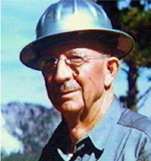 J. Harlen Bretz. (Illinois State Geological Survey) |
||||
|
Bretz first proposed his hypothesis and coined the term ‘Channeled Scablands’ in a 1923 paper titled “The Channeled Scabland of the Columbia Plateau”. Bretz first presented his ideas at the 1923 annual meeting of the Geological Society of America, where he hypothesized that the scablands were formed from glacial erosion and flowing water from glacial ice (Alt, 2001). Throughout the next 5 years, Bretz published a series of papers presenting his evidence and eventually concluded that the Scablands were formed in a single catastrophic flood, in which a massive volume of water scoured the landscape (Alt, 2001). Bretz was invited to present his ideas at the annual meeting of the Geological Society of Washington, D.C., in 1927. His presentation, “The Channeled Scabland and the Spokane Flood”, was not favorably received. Most of the participants dismissed the gigantic flood theory as preposterous, though it was noted that only one of the critics, whose response was printed, had actually been to the area (Proceedings of the Academy and Affiliated Societies: Geological Society 423d Meeting, 1927). |
|||||
|
|||||
Channeled Scablands
“It was a debacle which swept the Columbia Plateau.” (Bretz, 1923 p.649)
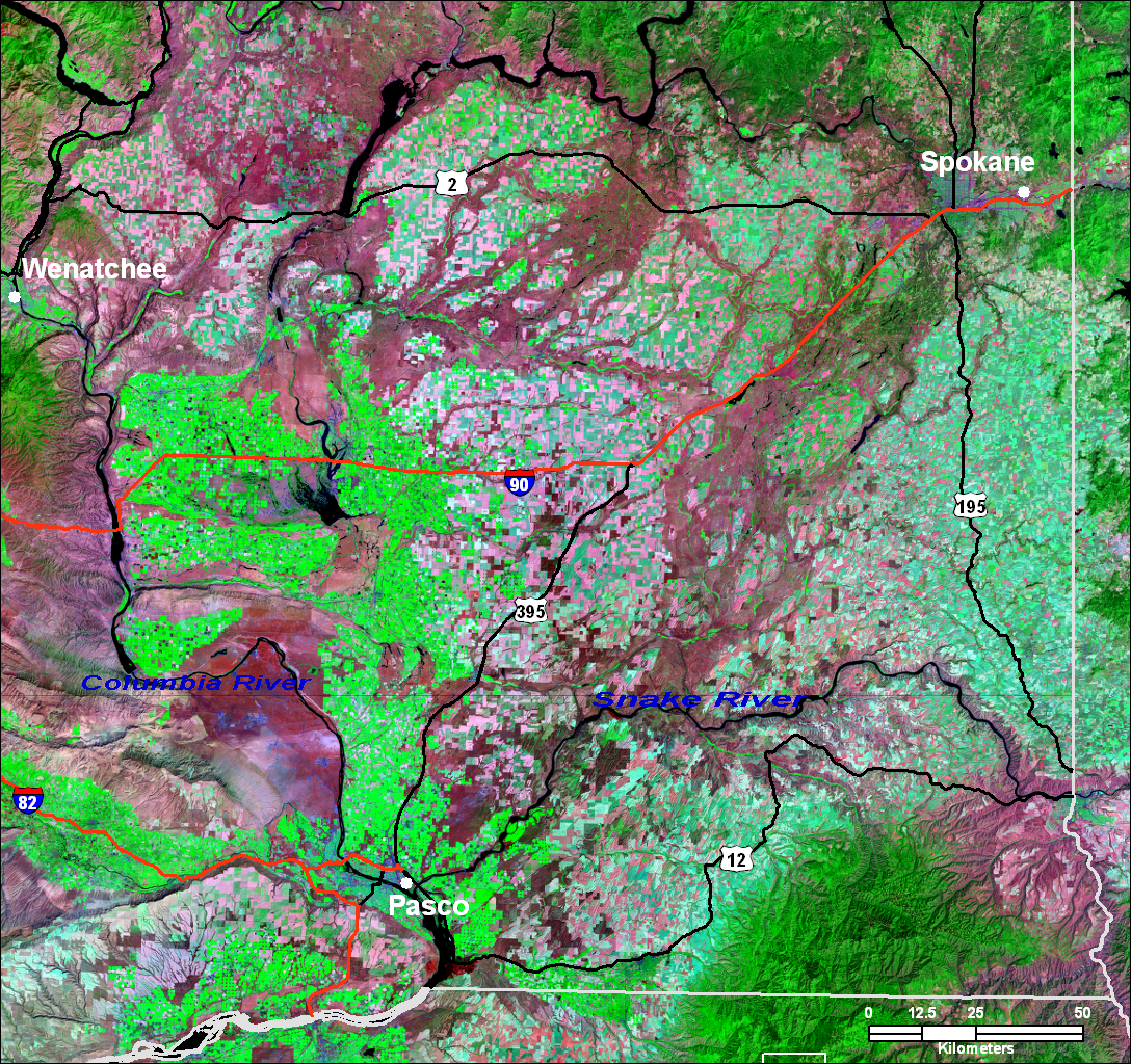 LANDSAT image of Channeled Scablands. |
During the last Ice Age, glacial silt and dust (loess) from continental glaciers were deposited by wind across Eastern Washington (Allen et al., 1986). Before the floods, the entire Columbia Basin featured mature topography in the form of loess-covered hills up to 200 feet thick (Bretz, 1923). An ice dam broke, sending torrents of water, ice and debris across Eastern Washington. An estimate of the maximum rate of flow is 40 cubic kilometers per hour (9.5 cubic miles per hour), or about 10 times the combined flow of all the rivers of the world. Once the water flowed past Spokane, the water eroded the loess and exposed the basalt bedrock underneath (Weis and Newman, 1976). About 2800 square miles were scoured (Bretz, 1923). The satellite image on the right shows the full extent of the Channeled Scablands across the entire region. The floodways are clearly visible in darker pink, and agricultural areas are visible in bright green and light pink. |
Scabland Features
|
There are many features attributed to the erosion caused by the flooding. They include the plucking of basalt, deep canyons, plunge pools, and cataracts. Three giant rivers temporarily formed: the Cheney-Palouse Tract, the Crab Creek Channel, and the western-most river carved Grand Coulee. Grand Coulee is the largest channel at about 50 miles long and over 900 feet deep (Weis and Newman, 1976). |
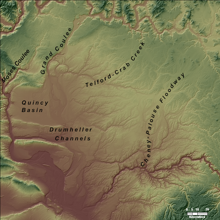
Cheney-Palouse Floodway
|
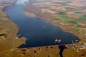
The Cheney-Palouse floodway is about 75 miles long and about 20 miles wide. The floodway drains to the Snake River (Bretz, 1928). There are only a few loess islands near the upper portion of the floodway, but further south the channel splits. Within the channels, there are currently hundreds of small lakes formed from the scouring and plucking of bedrock (Allen et al., 1986). |
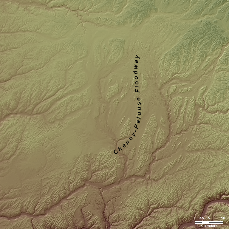 Shaded relief map of Cheney-Palouse floodway. The floodway began in the upper north-east corner of the map and flowed across the entire map above. Click on the map for a full size version.
|
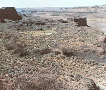
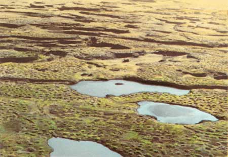 Cheney-Palouse. Photo above show the small lakes that are present as a result of the scouring and plucking of bedrock. (National Park Service)
|
|
|
Travelling westward, the Telford-Crab Creek floodway is about the same width as the Cheney-Palouse, but about 15 miles downstream the floodway diverges and eventually drains to the Quincy Basin (Bretz, 1928). The Telford-Crab Creek floodway is widely distributed, but the channels follow a similar pattern of lakes and ponds, formed from the plucking of bedrock (Alt, 2001). |
|
Dry Falls
|
The floods cascaded over the bedrock forming several waterfalls, now abandoned and known as Dry Falls. They are more than 3 miles wide, about five times the width of Niagara Falls (Alt, 2001). At the base of the Dry Falls, plunge pools formed by flowing water tearing out rocks at the base of the falls. Today, the plunge pools are now salty kolk lakes (Allen et al., 1986). Dry Falls is the boundary between the upper and lower Grand Coulee. Today two dams, North and Dry Falls Dam, is located just upstream of Dry Falls, forming Banks Lake. |
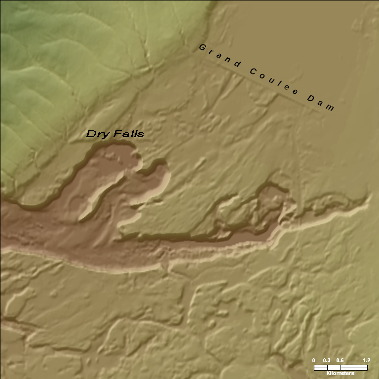 Shaded relief map of Dry Falls. Grand Coulee Dam is visible in upper right corner. |
||||
| |
|||||
|
|||||
Drumheller Channels
|
The Drumheller Channels have many of the erosional scabland features in a relatively small area. This area was the spillway from the Quincy Basin (Bretz, 1928). The landscape features butte and basin scablands for approximately 130 square kilometers. These channels were cut 100 meters into the basalt (Allen et al., 1986). The Frenchman Hills are the uneroded western boundary of the Drumheller Channels; they present a stark contrast to the rugged scablands. The O'Sullivan Dam is located on Crab Creek, and the northern half of the Drumheller Channels is currently flooded (Alt, 2001). |
 Shaded relief map of Quincy Basin in the upper left and Drumheller Channels in the center. |
|||||
|
||||||

Links
|
Portland State University Glacier Research |
Bibliography
|
Proceedings of the Academy and Affiliated Societies: Geological Society 423d Meeting. 1927. April 19, 1927. Allen, J. E., Burns, M., and Sargent, S. C., 1986, Cataclysms on the Columbia: a layman's guide to the features produced by the catastrophic Bretz floods in the Pacific Northwest. Timber Press, Portland, OR. 211 p. Alt, D., 2001, Glacial Lake Missoula and its Humongous Floods. Mountain Press Publishing Company, Missoula, MT. 208 p. Benito, G., and O'Conner, J. E., 2003, Number and size of last-glacial Missoula floods in the Columbia River Valley between the Pasco Basin, Washington, and Portland, Oregon: Geological Society of America Bulletin, v. 115, no. 5, p. 624-638. Bretz, J. H., 1923, The Channeled Scabland of the Columbia Plateau: Journal of Geology, v. 31, no. 8, p. 617-649. -, 1928, The Channeled Scabland of Eastern Washington: Geographical Review, v. 18, no. 3, p. 446-477. Minervini, J. M., O'Connor, J. E., and Wells, R. E., 2003, Maps showing inundation depths, ice-rafted erratics, and sedimentary facies of late Pleistocene Missoula floods in the Willamette Valley, Oregon: U.S. Geological Survey Map. Waitt, R. B. J., 1985, Case for periodic, colossal jökulhlaups from Pleistocene glacial Lake Missoula: Geologic Society of America Bulletin, v. 96, no. 10, p. 1271-1286. Weis, P. L., and Newman, W. L., 1976, The Channeled Scablands of Eastern Washington: The Geologic story of the Spokane Flood. US Geological Survey, Reston, VA. 23 p. |
Created 04/2001 9