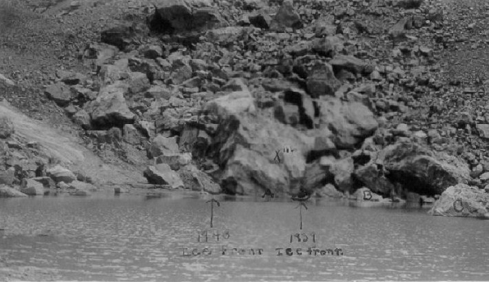
Andrews_1940_12
Submitted by admin on Thu, 2009-04-09 07:55

Asset Type:
Photo
Georeferenced:
No
Allow Full Scale Downloads:
Yes
Start Date:
1940
Asset Source:
<a href=""http://glaciers.research.pdx.edu/Asset-Sources#ROMO_Park_Archive"">ROMO Park Archive</a>

Photographer:
Paul W. Nesbit
Scanee:
John Achuff
Notes:
Dotted overlay between rocks A and B on photograph indicates position of ice front in 1939. This ice had completely evacuated the space between rock A and the walls of the valley to a point 16 feet 9 inches behind station x triple prime behind rock A. In 1939 it was 23 feet in front of x triple prime.The 1940 front is concealed behind rocks in the lower photograph at the point indicated.""""
